Mountain Biking near St. Louis
As the song goes, "You take the high road and I'll take the low road..."
Live it up! Explore 274-year-old ridge roads and ruins. Relive the settlements of yesteryear as you locate
their tiny Stonehenges. This is about mountain bikes and elevation.
The General Store is sits down in the valley at 786 feet while Hill 1133 is up at, well, 1133 feet uphill. It can be a good ride.
Both Low and High go up to the Crowbar Mine where you can see for 5 ridges on a clear day, or even higher to
the top of Hill 1133, one of the highest hills in Ste. Francois County. This ride would be considered
a pro grade, like a Black Slope in skiing.
- The High Road East.
Begin: General Store at 14117 VMSchRd. The object: get up that hill to the trail at the top
of the hill by either of two trails (I prefer the one behind the white house across the parking lot).
Follow that to the left (south) and you (eventually) join the Rock Road [see "Low Road" below].
- The High Road West.
Begin: take the Orchard Road behind the White Log Cabin up the hill. Turn
right at the top onto the very narrow mining haul road. It goes between a pair of trees big enough
for an oxcart or a mountain bike. The former ball field waits on the left, the Milk Truck straight,
or fork right to go downhill to the railroad right-of-way [the tracks and railway are gone].
Ride to the Haunted Tunnel [left] or the Quick Shop Gas Station [right].
- The Low Road.
Begin at the Lost History Museum at 14117 VMSch.Rd.
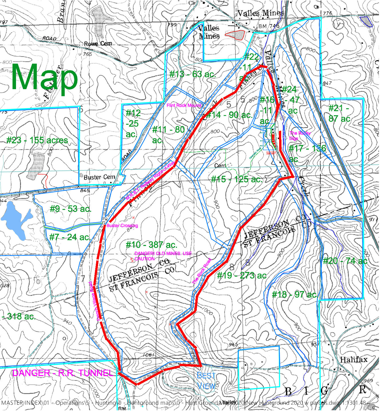
Print this map:
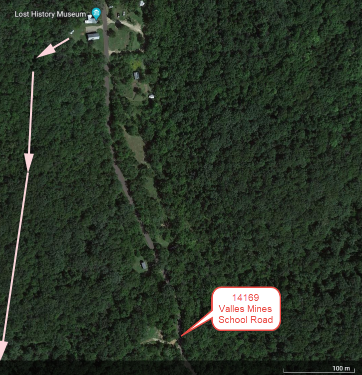
Ride to 14169 on asphalt pavement. Follow the
gravel road uphill to the washed out bridge, take 5, then continue (and maybe walk your bike) up and over
the hill. It's downhill from here for a very long time.
"I rode downhill for miles. Pack a lunch and something cold to drink. I wish I had."
Valles Mines had 8 Secrets, the Lost Villages.
So far we have found 6 of them:
- old town Valles Mines,
- Halifax,
- Prospect School,
- Tunnel Station,
- The Big Lode Mine and
- The Garottee Mine.
The Bisch and the Perry, ghost villages now, have remained lost since the Civil War,
possibly destroyed purposely to keep them from the enemy's hands.
Mining ended 95 years ago but the roads and trails still connect the villages,
deep inside the boundaries of the property. Road systems connect everything:
The Rock Road forms a central 5.5 mile ring that
goes to the General Store in the old town, Tunnel Station and The Big Lode Mines.
It joins French Village Road at Buster (Cemetery) Crossing and by way of the old
Halifax Post Office Road to French Village, connects eventually to Ste. Genevieve.
Back in the interior of teh property it seems as if you cannot get farther away
from the city and still be this close by. From HIlo 1133 it's a downhill ride for miles.
Paved County Roads now connect the General Store to the Old Dairy Farm to Hardin Road
past Cole Lake Airport to Silver Springs Roads to Berry Road
past the Radio Tower back to Valles Mines School Road to the
General Store. That makes it 12 miles around the outside of the property on
paved county roads. If you liked the Katie Trail, try the former railroad
(MRBT or Mississippi River and Bonne Terre) right of way to the Haunted Railroad Tunnel. Watch for Tunnel Bill.
Visitors need permission
You must purchase a seasonal or daily permit.
Call 573-631-6875 to buy a permit, get directions, orientation, etc. We are
privately owned and pay our own insurance and taxes. So buying a permit helps
our efforts to maintain the lands you ride over as well as our efforts to
preserve wildlife and upgrade our timber stands.
The place takes some getting used to. Many square miles with abandoned county roads,
trails, lakes, lookout points, etc. make it
possible to get lost easily, often for hours. If this is not what you want to
do, we recommend you stay on familiar trails to start with.
TEST YOUR GPS USING UTM COORDINATES
Compass or GPS users might like to download
our UTM GPS map. [NOTE TO MAP PEOPLE] If you use quad sheets for your maps, you may need Halifax,
Bonne Terre, French Village or Vineland, depending on where you go.
If that's too techy, consider using
our Horse People map instead.